University of Minnesota
http://www.umn.edu/
612-625-5000
http://www.umn.edu/
612-625-5000
Minnesota Biodiversity Atlas
Bell Museum
Dataset: MIN-Bryophytes
Search Criteria: Sweden; Västernorrlands län; excluding cultivated/captive occurrences
1
Page 1, records 1-2 of 2
Bell Museum bryophytes | |
 MIN:Bryophytes | 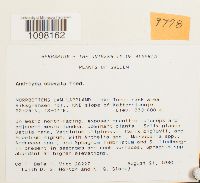 Andreaea obovata Thed. 731687[1098162]Dale H. Vitt 262271980-08-21 SWEDEN, Västernorrlands län, NORRBOTTENS LAN LAPPLAND. Lake Tornetrask area: Riksgransen hpl, NNE slope of Katternjunnje., 63.416667 18.116667, 550 - 800m |
MIN:Bryophytes |  Anthelia julacea (L.) Dumort. 731669[1099229]Dale H. Vitt 262331980-08-21 SWEDEN, Västernorrlands län, NORRBOTTENS LAN LAPPLAND. Lake Tornetrask area: Riksgransen hpl, NNE slope of Katternjunnje, 63.416667 18.116667, 550 - 800m |
1
Page 1, records 1-2 of 2
Google Map
Google Maps is a web mapping service provided by Google that features a map that users can pan (by dragging the mouse) and zoom (by using the mouse wheel). Collection points are displayed as colored markers that when clicked on, displays the full information for that collection. When multiple species are queried (separated by semi-colons), different colored markers denote each individual species.